| Chapter 7. External datasets | ||
|---|---|---|
 | Part II. Using Debrief |  |
| Chapter 7. External datasets | ||
|---|---|---|
| | Part II. Using Debrief | |
Table of Contents
Figure 7.1. Natural Earth logo

“Natural Earth is a public domain map dataset available at 1:10m, 1:50m, and 1:110 million scales. Featuring tightly integrated vector and raster data, with Natural Earth you can make a variety of visually pleasing, well-crafted maps with cartography or GIS software.”http://www.naturalearthdata.com/
Whilst Debrief users have enjoyed VPF and ETOPO reference datasets for vector and raster backdrops (resp) for over 10 years,these have now been superceded by the Open Source Natural Earth dataset. Natural Earth vectored data doesn't come with any styling, so the team employed a very clever professional cartographer (Julie at http://jewelcartografx.com/) to produce a set of themes to apply to the various Natural Earth feature types.
The Natural Earth download size has also be reduced by focussing on a specific set of features of interest to the maritime domain. Lastly, the data-points in this set of data-files have been subtlely trimmed to remove points at the poles, to make them suitable for Debrief's mercator projection. The data-point trimming was performed with the most excellent QGis application (http://qgis.org).
The detailed Natural Earth data is around 80Mb in size, so it's too large to include with Debrief. So, only they very highest scale, lowest resolution data is included with Debrief. This gives a world coastline and named countries. If you require more detailed data (which you almost certainly will), just download the more detailed dataset and unpack it on your disk - as detailed below.
The customized set of Natural Earth data can be downloaded from this GitHub repository: https://github.com/debrief/NaturalEarth. You don't need to download the individual files, just click on the button to the bottom-right of the page. The zip file is about 25Mb. This will download a zip-file of the data (obviously).
Once you've downloaded the data, unzip it into a nice safe folder on your system. It should expand to around 80Mb.
Ok, you've got the data on your system. Now you need to tell Debrief where it's stored. You do this from Debrief's Natural Earth preferences page. So, go into / and the dialog will open. Then select from beneath . In that form, just browse to the unzipped Natural Earth folder.
Unlike the previous external reference datasets, Natural Earth is kid's play. You really do just have to click on the Natural Earth icon, from the Chart Features menu, or the main application toolbar:
The Natural Earth layer doesn't have any configurable properties - all of that has been done for you already.
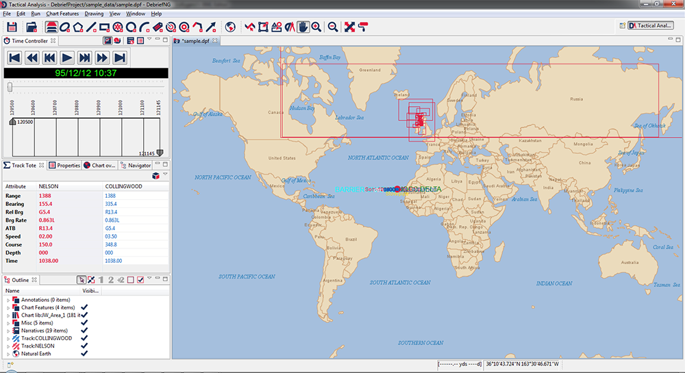
If you haven't downloaded and configured the detailed dataset, or if you're zoomed out a long, long way, you will see the 110M resolution dataset:
Figure 7.2. Natural Earth in use (110M resolution)
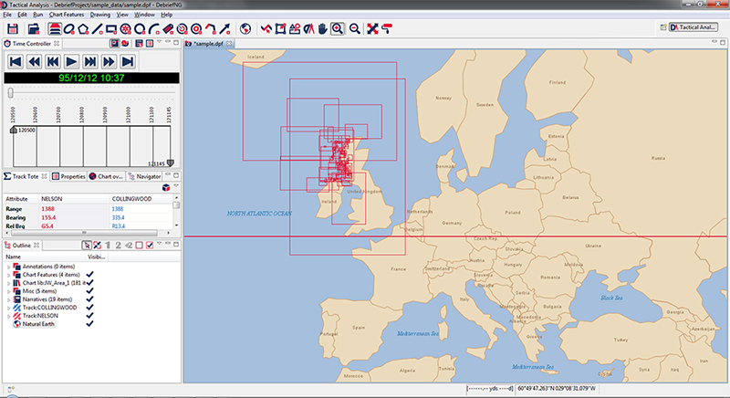
Zoom in a little more and you will start to see names of significant places and a more detailed coastline, from the 50M resolution dataset:
Figure 7.3. Natural Earth in use (50M resolution)
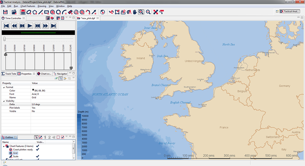
Finally, once you're zoomed in close you will see bathymetric data, plus a lot more placenames:
Figure 7.4. Natural Earth in use (10M resolution)
| |  | |
| Chapter 6. Symbol sets |  | 7.2. VPF data |